CyclePhilly 2014, United States of America, Philadelphia
Smartphone app and complimentary backend and public website.
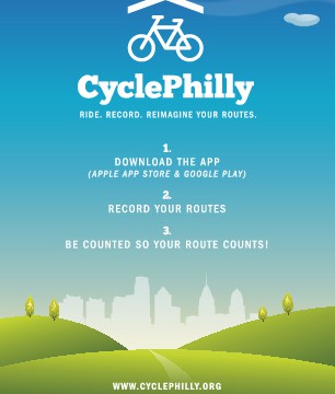

CyclePhilly. Ride. Record. Reimagine Your Routes. CyclePhilly is a smartphone app for recording bicycle trips. Data from the app can be used by regional transportation planners in the Philadelphia area to make Philly a better place to ride.
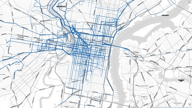
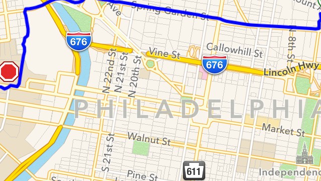
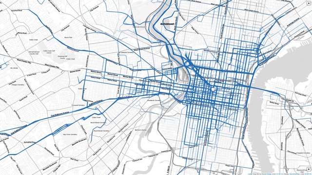
CyclePhilly is an open-source smartphone app and web-based project that crowdsources raw bike route choice data from bicyclists as they ride. Prior to CyclePhilly, transportation planners were limited to traditional census data or traffic counters commonly used to plan new bicycle paths. Without knowing route-choice, i.e. what led bikers through those intersections, planners could not plan around actual biking habits. CyclePhilly fills that gap by using smartphone GPS to provide exact origin, route, and destination information cross-referenced with voluntary demographic information. Thus, using citizen-generated data, transportation planners can, for the first time, study bicyclist route choice, facility preference, origin-destination patterns, trip length, travel speed, and more. Data from the app is used to inform bicycle planning work, and also to improve bicycle forecasting capabilities to better predict bicyclist response to new investments. Knowing exact route choice preferences also proves extremely important in a city with limited resources such as Philadelphia. Bikers have many incentives to use the app. First, by sharing where they ride, they are helping planners prioritize bicycle facilities that make sense for the people that actually use them. Second, there are few easier ways for bicyclists to engage in civic activism in a meaningful way that will change the Philadelphia landscape for the better. Indeed, the app provides riders with an extremely easy way to voice their bike-route choice preferences. All they have to do is take out their phone and press a button - something they do hundreds of times a day anyway. As an additional incentive for volunteering their data, bicyclists can compare their trips using a web-based map visualization of routes recorded with CyclePhilly. The map visualization represents an abstract yet aggregate and very tangible view of the impact bicyclists are making on bicycle infrastructure in Philadelphia.
http://www.cyclephilly.org/rides/index.php
http://technical.ly/philly/2014/04/30/cyclephilly-dvrpc-corey-acri/
Details
Building or project owner : Code for Philly
Project artist/ concept/ design/ planning : Corey Acri, Lloyd Emelle, Kathryn Killebrew, Chris Alfano - Code for Philly, Philadelphia, PA, USA; Greg Krykewycz, Elise Turner, Stephanie Lipartito, Chris Pollard - Delaware Valley Regional Planning Commission, Philadelphia, PA, USA
Project co-ordination : Corey Acri, Lloyd Emelle, Kathryn Killebrew, Chris Alfano - Code for Philly, Philadelphia, PA, USA; Greg Krykewycz, Elise Turner, Stephanie Lipartito, Chris Pollard - Delaware Valley Regional Planning Commission, Philadelphia, PA, USA
Interaction design/ programming : Corey Acri, Lloyd Emelle, Kathryn Killebrew - Code for Philly, Philadelphia PA, USA
Descriptions
Urban situation : Data visualization of near real-time trips recorded throughout the Philadelphia region.